Companion Resource
World Fabric Map
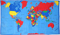
This fabric map is an excellent resource for "hands-on" geography activities. The cotton fabric washes well and can be taken outside. Countries and their capitals, and major bodies of water are identified. Each map has been serged around the edges. Order the map individually, or add on a set of Herbs and Spices Cards, Where in the World Food Cards, or Lunch Cards. Students will use the cards to identify where in the world each of the foods come from. Order this map online from agclassroomstore.com.
URL
Author
National Center for Agricultural Literacy (NCAL)
Lessons Associated with this Resource
- Cultures, Food, and Communities Around the World (Grades K-2)
- The Columbian Exchange of Old and New World Foods (Grades 3-5)
- Cultures, Food, and Communities Around the World (Grades 3-5)
- Tasty Testing
- The Columbian Exchange of Old and New World Foods (Grades 6-8)
- Geography and Climate for Agricultural Landscapes (Grades 6-8)
- Herbs and Spices of the World
- The Columbian Exchange of Old and New World Foods (Grades 9-12)
- Global Trade and Interdependence
- Geography and Climate for Agricultural Landscapes (Grades 9-12)